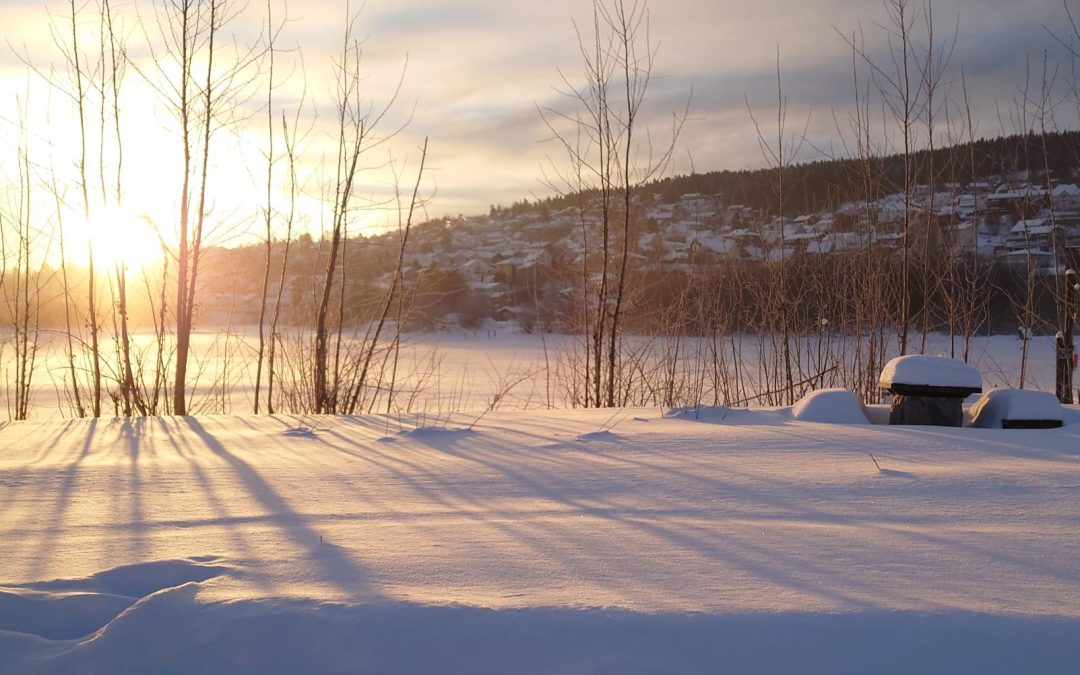
The Scandinavians have noticed one thing about the start of the new year – it is cold! But what is the cause of this drop in the temperature? We have gotten one of our experts in meteorology – Dr Sigmund Guttu – to explain this cold weather.
The start of the winter season 2023/2024 is cold. In the first week of 2024, Scandinavia might experience the coldest temperatures of the decade. The factors contributing to these cold anomalies in our region, are many and complex.
“The current weather circulation is characterized by a high pressure over Northern Scandinavia. This brings air masses to Scandinavia from the northeast”, says Sigmund Guttu, senior advisor and meteorologist in Kjeller Vindteknikk. “The air masses from Northwest Russia and Siberia are usually cold, and the temperatures there have been even lower than normal in December. Therefore, the temperatures and the weather circulation are providing a stream of colder air into Scandinavia – giving us icy temperatures.”.
But, the colder temperatures did not suddenly appear. In fact, the temperature in Scandinavia has been colder than usual also during the fall and end of 2023. What causes this? With the complexity of our atmosphere, there is seldom a straight forward answer. One clear candidate is the circulation in the stratosphere, which is the atmospheric layer 10-50 km above the ground. Every winter, very cold temperatures form in the stratosphere over the polar region, surrounded by strong winds from the west. This is the so-called polar vortex, which is created in every August and disappears again every April. The Arctic polar vortex has a strong year to year variability, and it has the potential to dominate the surface weather regionally. “So far this winter, the polar vortex position and the associated cold temperatures has been oriented more towards the Eurasian continent than normal. This may have contributed to a persistent cold plume over Scandinavia for most of the fall and early winter”, says Sigmund.
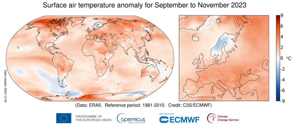
The September-November temperature anomaly globally (left) and for Europe (right). Scandinavia stands out as the only region with cold anomalies in Northern Hemisphere. From Copernicus Climate Change Service/ECMWF
So, for those loving the cold weather, and for those wishing it will pass soon, what can we expect of winterly weather for the rest of January? Right now, a rapid weakening of the polar vortex occurs above us. This phenomenon is a temperature rise called a “sudden stratospheric warming”. This brings weaker winds from the west, and often a weaker jet stream in the troposphere (between the stratosphere and the surface). We expect that this will cause a steady high-pressure system north of the North Atlantic Ocean. “Such a weather pattern favors transport of cold air from the Arctic towards the south. This is not necessarily limited to Scandinavia, also larger parts of Europe might get a taste of the cold air. The predictions are (as usual) associated with high uncertainty. “, Sigmund says. In other words, we assume cold temperatures for a longer time, but only time can tell how cold it will be, and how long it will last.
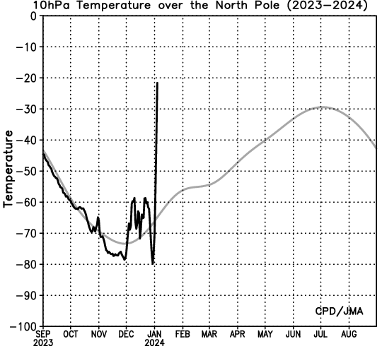
Arctic temperature evolution (black) at 10 hPa (approximately 30km above ground) for the current winter season along with the 1991-2020 climatology (gray). The rapid temperature rise of about 60 °C around New Year represents the ongoing “sudden stratospheric warming”, which might cause a cold January. From the Japan Meteorological Agency.